Subject: Asia
Period: 1720 (circa)
Publication: Atlas Historique
Color: Black & White
Size:
22.9 x 17.6 inches
58.2 x 44.7 cm
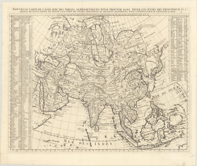
Fine map of Asia and the East Indies with extensive internal political and geographical details. This map is based on Delisle's general map of Asia with Novaya Zemlya shown connecting to the continent and Witsen's mountainous peninsula with a note that it is not certain where this point of land ends. Hokkaido (Terre de Yeco) is attached to Japan and separated from the mainland by a narrow Detroit du Jessor. The southern coast of Terre de la Compagnie appears to the east of Hokkaido. The Caspian Sea is shown in a rudimentary, round shape. The map extends to include all of the East Indies, the Maldives, part of New Guinea, Arabia, and the Red Sea. Keys at left and top right sides record the countries, principal cities, and major rivers of Asia.
References: Yeo #97.
Condition: A
A crisp impression issued folding, now flat, on watermarked paper with one short split at a fold junction that has been repaired with archival material on verso.