Subject: Persia - Iran
Period: 1850 (circa)
Publication:
Color: Hand Color
The maps from The Illustrated Atlas were first published in serial form to a target audience that led insular lives due to the expense and hardship of travel. All that changed as the progress of the nineteenth century brought swift and dramatic changes in public awareness of far away places. Tallis' maps no doubt played an important role in this dramatic awakening. These maps not only provided up-to-date geographical knowledge, but also used vignette views within the map's design to show the native people and their occupations, cities and points of interest. The maps hark back to a cartographic tradition from the Dutch mapmakers of the seventeenth century with finely engraved decorative borders. The maps were drawn and engraved by John Rapkin with views drawn and engraved by a number of prominent artists. The maps were issued as a complete volume from 1851 until about 1865. Some of the maps were also published in other history books published by Tallis including British Colonies and, without the vignettes, in geographical dictionaries and encyclopedias until about 1880.
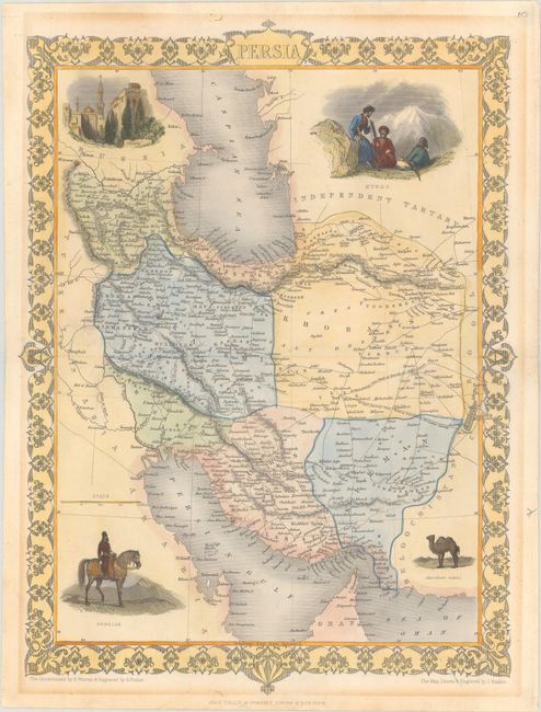
A. Persia, by John Tallis, from Illustrated Atlas and Modern History of the World, circa 1850 (9.9 x 13.7"). This finely engraved map of Persia extends from the Persian Gulf to the Caspian Sea. It is surrounded by beautifully engraved and rendered vignettes of a Bactrian camel, a Persian, Kurds, and the city of Isfahan. The map is enclosed by a delicately engraved decorative border. The map was drawn and engraved by J. Rapkin; the illustrations were drawn by H. Warren and engraved by S. Fisher. Condition: There is light mat burn in the blank margins and remnants of old tape along the sheet edges on verso.
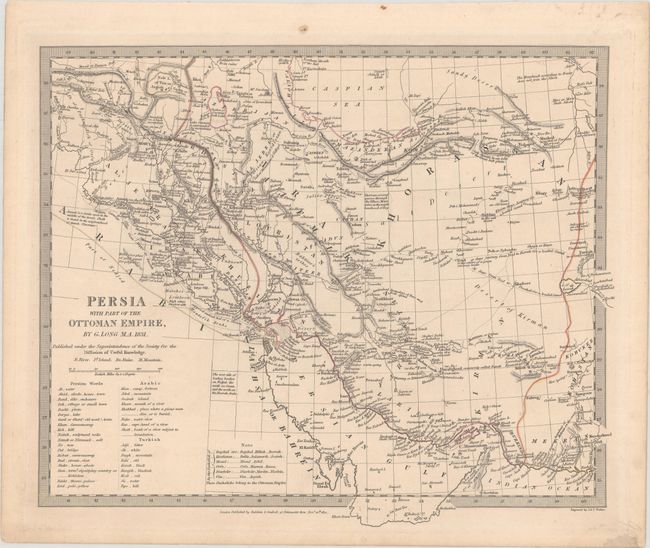
B. Persia with Part of the Ottoman Empire, by SDUK Society for the Diffusion of Useful Knowledge, dated 1831 (14.2 x 11.9"). This handsome SDUK map details present-day Iraq and Iran. It depicts the contemporary (1831) Ottoman Empire configuration, locating the cities of Babylon, Baghdad, Bosrah, Shiraz, Isphan, Tehran, and many more. A table translates Persian, Arabic and Turkish words to English. Condition: Light marginal soiling.
References:
Condition: A
See description above.