Catalog Archive
Auction 188, Lot 62

"Amerika, of de Nieuwe Weerld Aller eerst door C. Kolumbus Ontdekt, en Bevaren, int Jaar 1492", Aa, Pieter van der

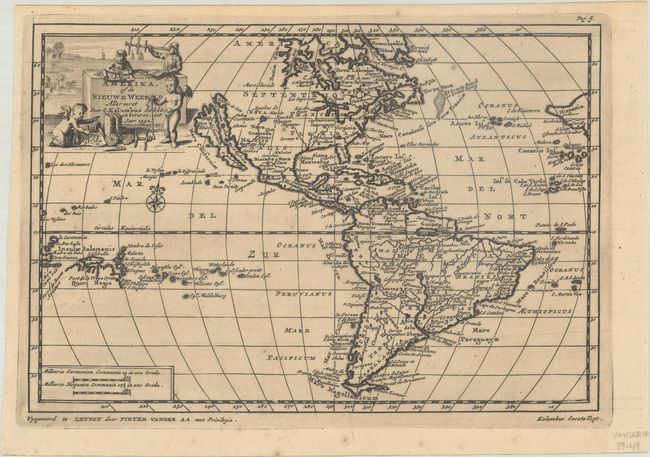
Subject: Western Hemisphere - America

Period: 1706 (circa)

Publication: Cartes de Itineraires & Voyages Modernes

Color: Black & White

Size:
8.9 x 6 inches
22.6 x 15.2 cm
Download High Resolution Image
(or just click on image to launch the Zoom viewer)

Charming map of the Americas with California as an island with an indented northern coastline. The Great Lakes are shown open-ended in the west and a major westward flowing river emanates from a large inland lake. In South America the mythical, equatorial Lake Parime is shown in Guyana, but is not named. The Insulae Solomis are prominent in the Pacific with Quiri Regio partially outlined, reflecting Dutch exploration in the vicinity of Australia. The delicate cartouche includes explorers and cherubs using navigation instruments.

References: McLaughlin #168.

Condition: B+

A dark impression, issued folding with minor of toning and a few small spots of foxing.

Estimate: $550 - $650

Sold for: $300

Closed on 6/22/2022

Archived