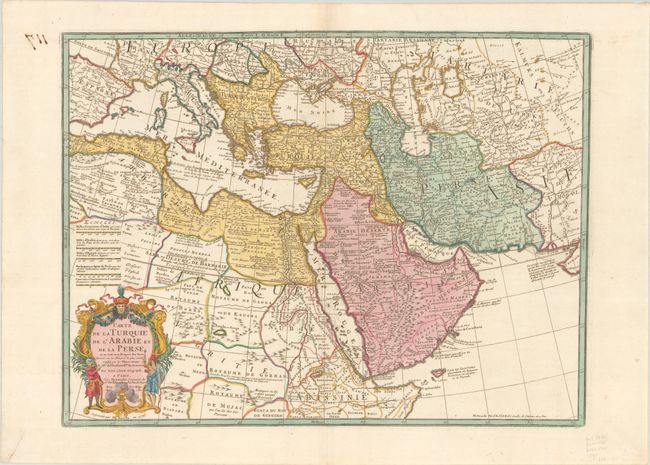
Subject: Mediterranean, Middle East & Northern Africa
Period: 1780 (dated)
Publication:
Color: Hand Color
Size:
24.7 x 18.6 inches
62.7 x 47.2 cm
Superb map of the Ottoman Empire stretching from the Balkans through present-day Turkmenistan in the north and including Northeastern Africa and the Arabian Peninsula. The map is boldly engraved, packed with information and decorated with a fine title cartouche. Delisle's maps of the Middle East were some of the most accurate early maps published until the end of the 18th century. This map was originated by Delisle, updated by Buache, and here published by their successor Dezauche.
References: Ankary, p. 294-95; Tibbetts #229.
Condition: A
A crisp impression on a bright, watermarked sheet with a repaired tear in the bottom left corner of the sheet and show-through at top left of manuscript map number on verso.