Subject: Western Italy
Period: 1652 (circa)
Publication: Accuratissima Orbis Antiqui Delineatio…
Color: Hand Color
Size:
19.3 x 13.6 inches
49 x 34.5 cm
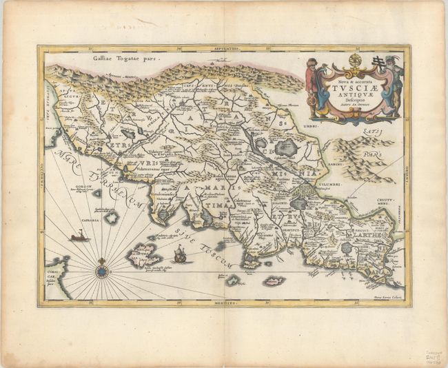
Pieter Van Den Keere (Petrus Kaerius) engraved this attractive map of ancient Tuscany. It is based on Ortelius’ map that was in turn based on Bellarmati's map supplemented by classical sources. The map is very detailed and includes the coastal islands. It locates the major Etruscan and Roman settlements and the Roman roads. The map is embellished with surveyors flanking the title cartouche, a compass rose, and sailing ships. Blank verso with manuscript number 32 on verso, published between 1652-84. First issued in Georgius Hornius' Accuratissima Orbis Antiqui Delineatio, which included maps from Johannes Jansson's historical atlas and Abraham Ortelius' Parergon.
References: Van der Krogt (Vol. I) #7200H:1.
Condition: A
A sharp impression with attractive coloring. There are some minor dampstains and centerfold repairs at top and bottom, well away from the map image.