Subject: Romania & Bulgaria
Period: 1652 (circa)
Publication:
Color: Hand Color
Size:
18.8 x 14.1 inches
47.8 x 35.8 cm
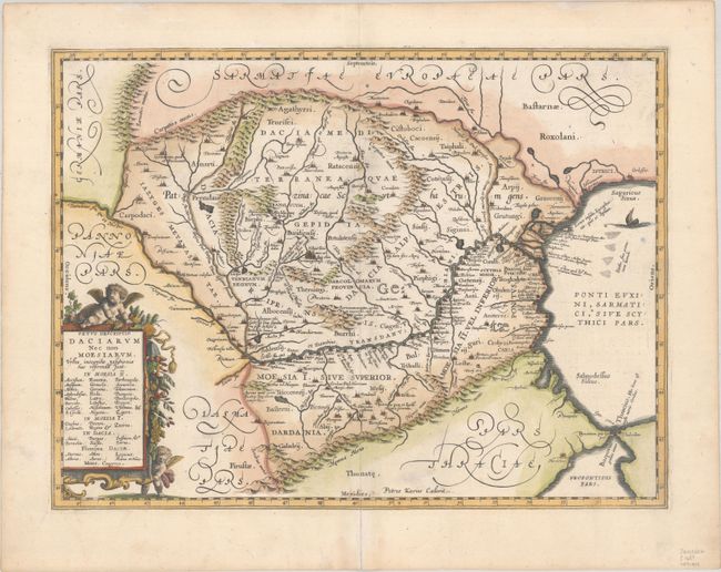
This impressive map of the area of Romania and Bulgaria centers on the Danube River. The map is based on Ortelius' map of the region, which was in turn based on classical sources. It was beautifully engraved by Petrus Kaerius to highlight the major cities, mountains, and rivers and is embellished by a garland-draped title cartouche with two putti and an oared ship in the Black Sea. Blank verso, possibly published in Georgius Hornius' Accuratissima Orbis Antiqui Delineatio (1652-84).
References: Van der Krogt (Vol. I) #7710H:1.
Condition: A
A fine impression with an archival repair to a centerfold separation that just crosses into map image at bottom.