Catalog Archive
Auction 188, Lot 510

Blaeu's Decorative Map of Russia

"Tabula Russiae ex Autographo, quod Delineandum Curavit Foedor Filius Tzaris Boris Desumta ... M.DC.XIIII", Blaeu, Willem

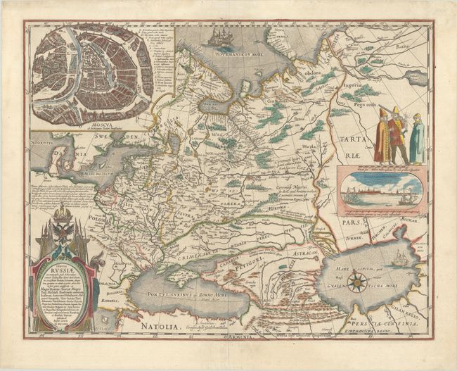
Subject: Russia in Europe

Period: 1642 (circa)

Publication:

Color: Hand Color

Size:
21.5 x 16.8 inches
54.6 x 42.7 cm
Download High Resolution Image
(or just click on image to launch the Zoom viewer)

This is Blaeu's version of Hessel Gerritsz' rare and significant map of Russia, which he compiled from manuscripts brought back by Isaac Massa. The map covers the European part of the Russian Empire extending from Poland to the steppes of Tartary, and from the Mourmanskoy More (Barents Sea) to the Black and Caspian seas. The large inset plan of Moscow is attributed to the Crown Prince Fydor Gudonov. The map is richly decorated with a large title cartouche, sailing ships, a compass rose, three Russian gentlemen, and an inset view of Archangel Sckagoroda. Dutch text on verso.

References: Van der Krogt (Vol. II) #1800:2.2.

Condition: A

A crisp impression with a professionally repaired centerfold separation at bottom. A couple of edge tears have also been expertly repaired.

Estimate: $1,800 - $2,100

Sold for: $1,300

Closed on 6/22/2022

Archived