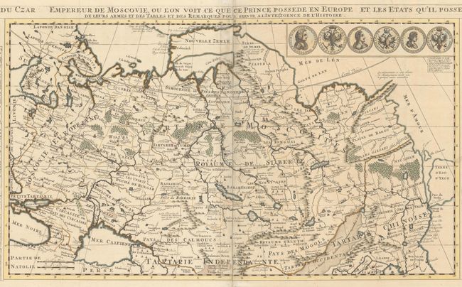
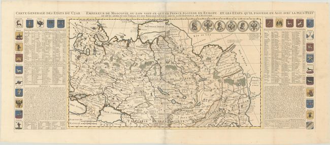
Subject: Russia, Eastern Europe & Central Asia
Period: 1719 (circa)
Publication: Atlas Historique
Color: Hand Color
Size:
38.5 x 15.1 inches
97.8 x 38.4 cm
This is a grand map of the Russian Empire extending from Finland to Siberia and Tartary. "Ukraine Pays des Cosaques" is noted north of Crimea within the region of Moscovie Europeane. Novaya Zemlya is shown connected to the mainland. Just below the Arctic Circle, Witsen's mountainous peninsula is shown with an unknown eastern coastline. The eastern coastline, with Terre d' Eso d'Yeco, is depicted via faint engraved lines and there is no Kamchatka Peninsula. The map is flanked by panels of French text with historical notes, the provincial coats-of-arms, and six medallions. Printed on two joined sheets, as issued.
References:
Condition: B+
A fine impression on two joined sheets, each with a Strasbourg bend and lily watermark. There is some minor toning along the centerfold, a few scattered wormholes that have been infilled on verso, and a few edge tears that have been repaired with tissue on verso, including one that crosses 1.75" past the neatline at top right.