Subject: Eastern Europe, Poland
Period: 1782 (dated)
Publication: Atlante Novissimo
Color: Hand Color
Size:
16.1 x 12.8 inches
40.9 x 32.5 cm
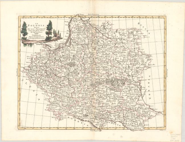
This elegantly engraved Italian map covers present-day Poland, Lithuania, Belarus, western Ukraine, and part of Latvia. It spans from Poznan to the eastern border of present-day Belarus, and from Riga south to the Moldova-Ukraine border. The region is divided into palatinates, and numerous towns and cities are named, including Gdansk, Warsaw, Krakow, Konigsberg (Kaliningrad), Vilnius, Minsk, Mogilev, Iwowleopol (Lviv), Ternopil, and more. The title cartouche is decorated with an idyllic vignette and attributes the cartography to the Polish atlas of Rizzi-Zannoni, a famous astronomer, surveyor & mathematician. Engraved by G. Zuliani, with lettering by G. Pitteri.
References: Shirley (BL Atlases) T.ZAT-1a, Vol. 2 #36.
Condition: A
A sharp impression on a sheet with a three crescent moons watermark. There is faint toning along the centerfold.