Subject: Southern Germany & Northern Switzerland
Period: 1639 (circa)
Publication: Nouveau Theatre du Monde
Color: Hand Color
Size:
19.4 x 15 inches
49.3 x 38.1 cm
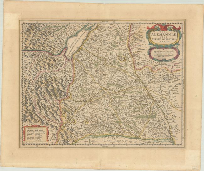
This handsome map focuses on the border region between Germany, Austria, and Switzerland, with the Danube at right and Lake Constance (Boden See) at the top. North is oriented to the right and the mountainous Alps are to the left. The map is decorated with a finely engraved title cartouche incorporating the scale of miles and another at lower left containing the key to symbols in Latin and German. French text on verso, published between 1639-46.
References: Van der Krogt (Vol. I) #2605:1.1.
Condition: B+
A crisp impression with contemporary color. There is light, uneven toning, much of it confined to the margins, and an area of printer's ink residue in the distance scale cartouche.