Subject: Northwestern France
Period: 1628 (circa)
Publication:
Color: Hand Color
Size:
18.4 x 13.8 inches
46.7 x 35.1 cm
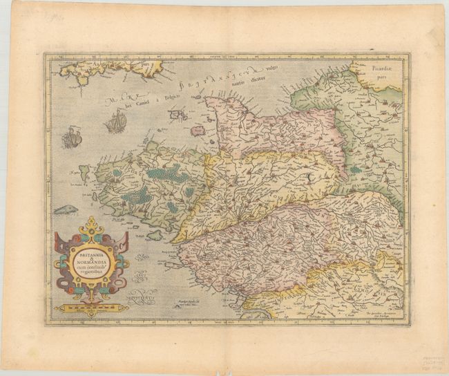
This is a fine early map of Brittany and Normandy decorated with a bold strapwork cartouche, sailing ships, and a sea monster. The map provides an excellent view of the cities, villages, rivers, mountains, and forests. This map first appeared in 1585 and was then published in Mercator's Atlas sive Cosmographicae... in 1595. In 1604, the copperplates for the atlas were sold to Jodocus Hondius, who reissued the Atlas beginning in 1606. French text on verso, published in either Gerardi Mercatoris - Atlas sive Cosmographicae... (1628) or Gerardi Mercatoris et I. Hondii Atlas... (1633).
References: Van der Krogt (Vol. I) #4001:1.
Condition: A
On watermarked paper with a short edge tear in the right blank margin that has been repaired with archival tape on recto and a pair of wormtracks along the bottom edge of the sheet.