Subject: Netherlands
Period: 1850 (circa)
Publication: Illustrated Atlas and Modern History of the World
Color: Hand Color
Size:
9.9 x 13.5 inches
25.1 x 34.3 cm
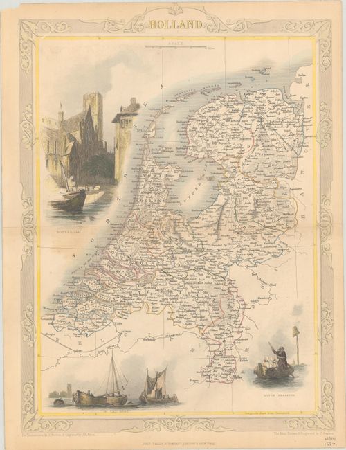
The maps from The Illustrated Atlas were first published in serial form to a target audience that led insular lives due to the expense and hardship of travel. All that changed as the progress of the nineteenth century brought swift and dramatic changes in public awareness of far away places. Tallis' maps no doubt played an important role in this dramatic awakening. These maps not only provided up-to-date geographical knowledge, but also used vignette views within the map's design to show the native people and their occupations, cities and points of interest. The maps hark back to a cartographic tradition from the Dutch mapmakers of the seventeenth century with finely engraved decorative borders. The maps were drawn and engraved by John Rapkin with views drawn and engraved by a number of prominent artists. The maps were issued as a complete volume from 1851 until about 1865. Some of the maps were also published in other history books published by Tallis including British Colonies and, without the vignettes, in geographical dictionaries and encyclopedias until about 1880.
This detailed map of Holland features three vignettes including Rotterdam, Dutch peasants, and boats on the Dort, Surrounded by a delicately engraved and decorative border. Illustrations were drawn by H. Warren and engraved by J.B. Allen, and the map was both drawn and engraved by J. Rapkin.
References:
Condition: B+
Attractive color with some minor color offsetting adjacent to the centerfold at left. There is a short repaired edge tear that just passes the border at top left.