Subject: England & Wales
Period: 1609 (circa)
Publication:
Color: Hand Color
Size:
18.4 x 13.8 inches
46.7 x 35.1 cm
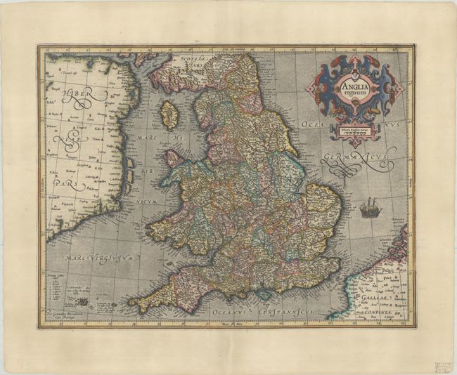
This attractive map of Elizabethan England is filled with names taken from Saxton's map of 1579. County boundaries and the Latinized names of counties are shown. The map is beautifully engraved in Mercator's characteristic style featuring a stipple engraved sea with a sailing ship, bold calligraphy, and a handsome title cartouche. French text on verso, published in either Gerardi Mercatoris - L'Atlas ou Meditations Cosmographuqies... (1609) or Gerardi Mercatoris - Atlas sive Cosmographicae (1619).
References: Shirley (BI to 1650) #181; Van der Krogt (Vol. I) #5100:1A.1.
Condition: A
A sharp impression on a sheet with a coat of arms watermark. There is a short centerfold separation in the bottom blank margin that has been professionally repaired on verso.