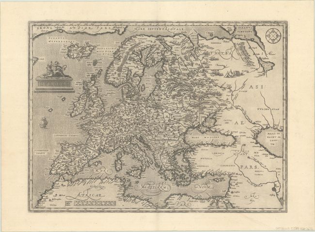
Subject: Europe
Period: 1579 (published)
Publication: Theatrum Orbis Terrarum
Color: Black & White
Size:
18.3 x 13.6 inches
46.5 x 34.5 cm
This handsome map was based on Gerard Mercator's 1554 map of Europe and incorporates Magnus' information on Scandinavia and Jenkinson's map for Russia. The map extends to include Iceland and part of Greenland, and there is a tiny bit of Labrador intruding into the map at upper left. It also extends into western Asia and Northern Africa based on Gastaldi's cartography. Finely engraved with a stippled sea and modestly adorned with a sailing ship, compass rose, and a tent encampment in Russia. The personification of Europa being abducted by Zeus in the form a bull graces the title cartouche. This is Ortelius' first map of Europe, which was replaced in 1584 with a new copper plate. Latin text on verso.
References: Van den Broecke #4.
Condition: A+
A sharp impression on a sheet with the crossed arrows watermark commonly found on Ortelius maps.