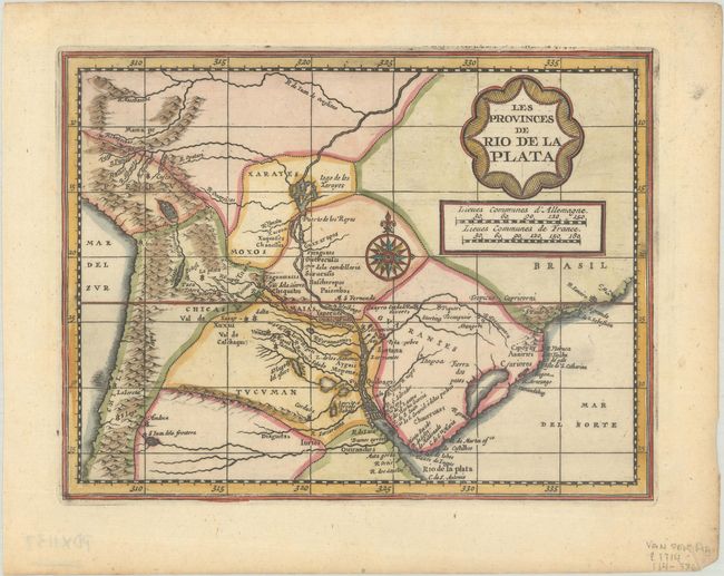
Subject: Central South America
Period: 1714 (published)
Publication: Atlas Soulage
Color: Hand Color
Size:
7.4 x 5.7 inches
18.8 x 14.5 cm
Extremely rare map of the region including the Paraguay River basin and the Peru-Chilean coast with Lake Titicaca. The Rio de la Plata is boldly shown with many large islands in the broad river, ending at the mythical Lago de los Xarayes..
This is an extremely rare variant of a map first published in Jansson's new Atlas Minor in 1648. This map appeared in Van der Aa's Nouveau Petit Atlas, which was published circa 1714. The atlas was composed of nine parts, with the general portion falling under Nouveau Petit Atlas and then 8 individual regional parts under the title Atlas Soulage. Van der Aa revised the plate by updating the title cartouche (in French with a new border) and making other small changes. The atlas was only issued once and there is only one known complete copy extant, in the University Library of Leiden.
References: Van der Krogt (Vol. III) #9900:352.2.
Condition: A
A sharp impression with a hint of toning and small remnants of hinge tape on verso.