Subject: Central South America, Peru
Period: 1605 (published)
Publication: Histoire Universelle des Indes…
Color: Hand Color
Size:
11.4 x 9 inches
29 x 22.9 cm
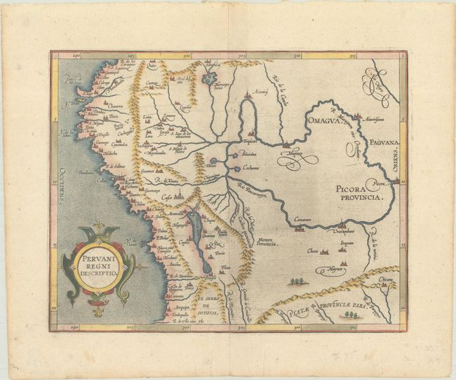
This important early map of Peru is finely engraved with numerous cities located throughout. Lake Titicaca is elongated and joined with Aulaga Lake. The map is embellished with a large strapwork title cartouche and a stipple engraved sea. This is the second state of the map, with the date removed from the title cartouche. The first state appeared in Wytfliet's Descriptionis Ptolemaicae Augmentum… in 1597, which is considered the earliest atlas to focus on the Americas. This edition is from the first French translation of Wytfliet's important atlas.
References: Mickwitz & Miekkavaara #309-6.
Condition: A
A nice impression with attractive color on paper with a fleur-de-lis watermark. There is a bit of printer's ink residue and marginal soiling. Remnants of hinge tape on verso and a bit of extraneous creasing in the bottom left margin.