Catalog Archive
Auction 188, Lot 285

"Carte des Antilles Francoises et des Isles Voisines Dressee sur les Memoires Manuscrits...", Delisle, Guillaume

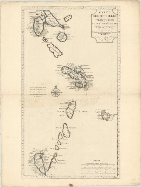
Subject: Lesser Antilles

Period: 1717 (dated)

Publication:

Color: Hand Color

Size:
14.6 x 25.4 inches
37.1 x 64.5 cm
Download High Resolution Image
(or just click on image to launch the Zoom viewer)

This beautiful chart is the first state of Delisle's map of the Antilles that extends from Guadeloupe to Grenada and includes Barbados. Numerous place names are shown, as are the locations of forts, churches, rivers and more. The most remarkable feature is the upside-down depiction of Grenada. The chart is centered on a large compass rose.

References: Tooley (MCC-33) #54.

Condition: B+

Contemporary outline color on paper with an IHS watermark. There is some minor staining around the centerfold and a small tear perpendicular to the centerfold that has been closed on verso with archival tape.

Estimate: $250 - $325

Sold for: $150

Closed on 6/22/2022

Archived