Catalog Archive
Auction 188, Lot 271

"Carte Reduite du Golphe du Mexique et des Isles de l'Amerique", Bellin, Jacques Nicolas

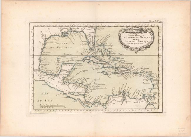
Subject: Gulf of Mexico & Caribbean

Period: 1764 (circa)

Publication: La Petit Atlas Maritime

Color: Hand Color

Size:
12.1 x 8.3 inches
30.7 x 21.1 cm
Download High Resolution Image
(or just click on image to launch the Zoom viewer)

A handsome map of the Caribbean covering the region from St. Augustine, Florida, and the Florida peninsula, across the Gulf of Mexico and down to the northern coast of South America. It presents excellent coastal detail including numerous place names, capes, bays, offshore islands, anchorages, shoals and more. Adorned by a decorative rococo-style title cartouche that floats in the upper right corner.

References: Phillips (Atlases) #638.

Condition: A

On paper with an IHS watermark. There is faint offsetting and some scattered foxing confined to the blank margins.

Estimate: $150 - $180

Sold for: $75

Closed on 6/22/2022

Archived