Subject: Mexico, Mexican-American War
Period: 1847 (dated)
Publication:
Color: Black & White
A nice pair of Mexican-America war maps:
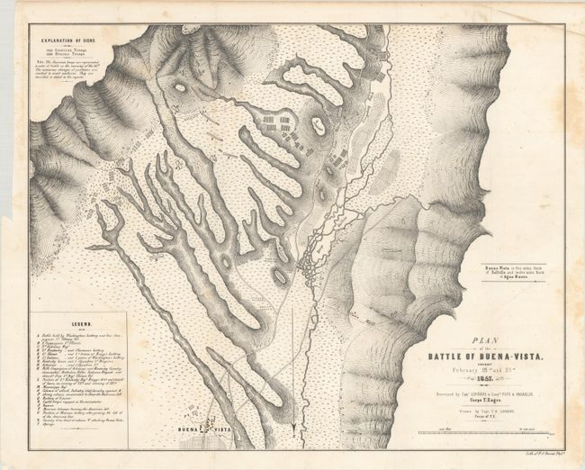
A. Plan of the Battle of Buena-Vista. Fought February 22nd and 23rd 1847 (20.4 x 16.2"). Lithographic map drawn by Capt. Linnard and surveyed by Lieutenants Pope and Franklin. A very detailed battle plan showing a crucial battle in the Mexican-American War. Outnumbered nearly 5 to 1, General Taylor's forces held, defeating the advancing Mexican forces under General Santa Ana and ending the war in northern Mexico. In March, Santa Ana returned to Mexico City where he became president of Mexico. Taylor continued to command the U.S. forces in northern Mexico, then returned to the states in November 1847 and became president the following November. A legend notes troop locations during the battle with relief shown by hachure.
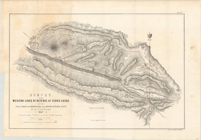
B. Survey of the Mexican Lines of Defence at Cerro Gordo, and the Lines of Attack of the American Army Under Major General Scott, on the 17th and 18th of April 1847 (19.0 x 12.5"). This map illustrates one of the major battles of the Mexican-America War. It shows mountains, roads, Mexican and American camps, gun batteries and the route of Shield's Brigade. Santa Ana had taken up a position at the pass of Cerro Gordo, thinking to halt Gen. Scott's advance on Mexico City. After fierce fighting, the Mexican forces were completely defeated, surrendering 3,000 prisoners (including 5 generals), over 4,000 stands of arms, and 43 pieces of artillery. American losses were 64 killed and 353 wounded. Surveyed by Major Turnbull and Captain McLellan.
References:
Condition: B+
Issued folding with light scattered foxing.