Subject: Texas, Gulf Coast
Period: 1852-66 (dated)
Publication:
Color: Black & White
The Office of Coast Survey is the oldest U.S. scientific organization, dating from 1807 when Congress directed that a "survey of the coast" be carried out. By 1836, it was called the U.S. Coast Survey and in 1878, the name was changed to the U.S. Coast and Geodetic Survey. Today the Office of Coast Survey is a division of the National Oceanic and Atmospheric Administration NOAA.
The survey teams, composed of civilians as well as Army and Naval officers, charted the nation's waterways and produced a wide array of reports, survey charts, hydrographic studies of tides and currents, astronomical studies and observations, and coastal pilots. These charts are an important record of the changing nature of the nation's coastlines. In additional to coastal charts, the U.S. Coast and Geodetic Survey produced land sketches, Civil War battle maps, and the early aeronautical charts.
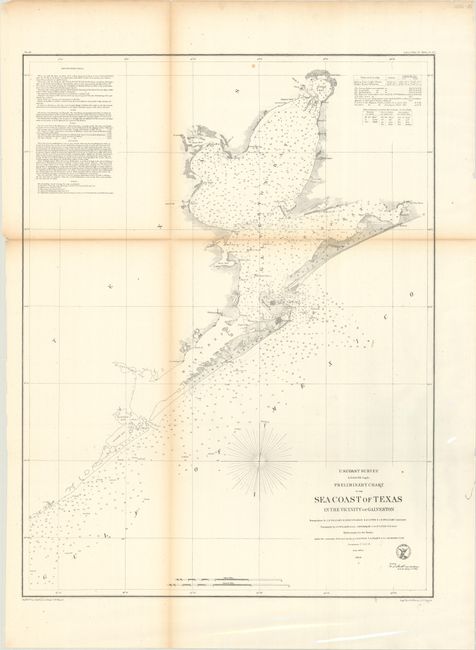
A. Preliminary Chart of the Sea Coast of Texas in the Vicinity of Galveston, dated 1856 (19.4 x 25.4"). This chart is centered on the city of Galveston, but continues northward to show the entire bay. It extends on the coast west beyond Oyster Bay, and east beyond Bolivar Peninsula to Muscle and East Bay points. Details include buoys and beacons, a light boat, shoals, reefs, and is filled with soundings, bottom types, extensive notations on sailing directions, tides, etc. In Galveston Bay, the mouth of the San Jacinto is depicted as is Turtle Bay. Condition: Issued folding with light toning and a few short separations along the folds. (B+)
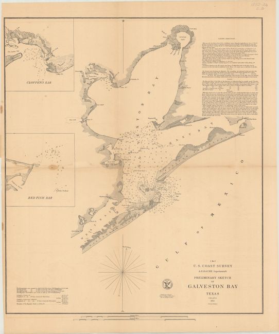
B. Preliminary Sketch of Galveston Bay Texas, dated 1852 (16.8 x 19.3"). The second edition of this handsome coastal chart shows the entire Galveston Bay with the city located at its entrance on Galveston Island. Includes insets of Clopper's Bar and Red Fish Bar. Extensive sailing instructions and the seal of the U.S. Coast Survey complete the chart. Condition: Issued folding on a toned sheet with a couple light dampstains at left, a few short fold splits, and minor offsetting. (B)
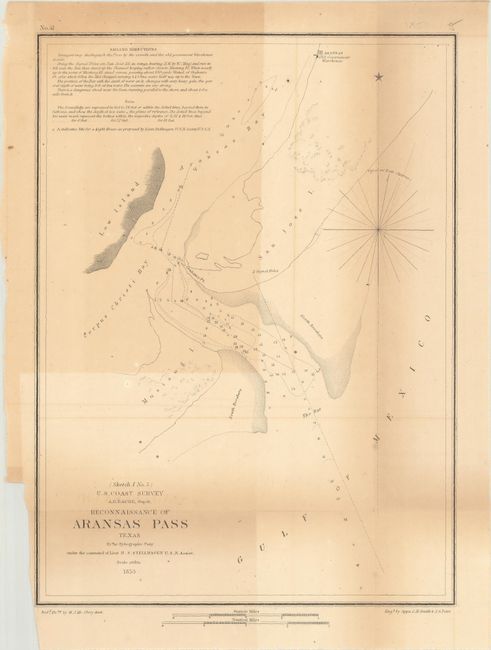
C. Reconnaissance of Aransas Pass Texas, dated 1853 (9.1 x 12.3"). This small chart zooms in on the confluence of the Corpus Christi and Aransas bays and identifies Low, Mustang, and San Jose islands. Condition: Issued folding with uneven toning, a few spots, and a binding trim confined to the left blank margin. (B)
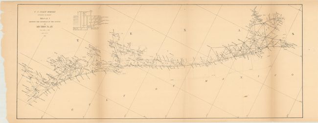
D. Sketch I Showing the Progress of the Survey in Section No. IX from 1848 to 1866, dated 1866 (25.2 x 10.1"). This chart shows the extensive triangulation work in the region from 1848-66, including Corpus Christi, Aransas, Matagorda, and Galveston bays. Condition: Issued folding on a toned sheet with a 1" edge tear at top. (B)
References:
Condition:
See description above.