Subject: South Carolina
Period: 1848 (published)
Publication:
Color: Hand Color
Size:
19.3 x 15.8 inches
49 x 40.1 cm
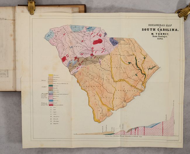
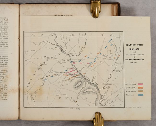
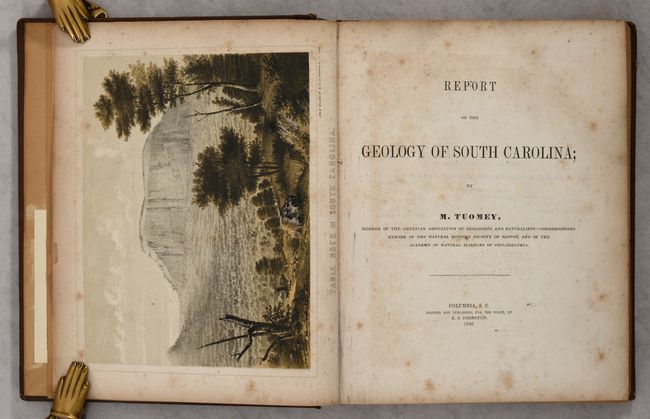
This important map is the first geological map made of South Carolina. It is complete with the original Report on the Geology of South Carolina. The map identifies 15 different geologic types shown via coloring and pattern. The legend also locates Iron, Gold, Copper, Lead, Mangaese, Bismuth, Plumbago, and Soapstone. A large and colorful profile shows the region from Charleston through Columbia to Saluda Gap. The report contains numerous engravings in the text plus the folding Map of the Iron Ore and Limestone Region of York and Spartansburgh Districts (11" x 7"), which identifies three types of iron ore and limestone. Octavo, 293 pages plus appendix and index.
This example includes a presentation inscription from Oscar M. Lieber, an assistant to Tuomey and South Carolina State Surveyor in the 1850s. Lieber later fought for the Confederacy and was mortally wounded in battle.
References: Marcou & Marcou #546.
Condition: B+
The colorful folding map is mostly clean and bright with some minor foxing and offsetting. Text has scattered foxing and uneven toning. Ex-library with a blind stamp on the title page and bookplate on the front pastedown. Inscribed on the front free endpaper. Modern binding has average wear with a small chip at the top of the front cover.