Catalog Archive
Auction 188, Lot 230

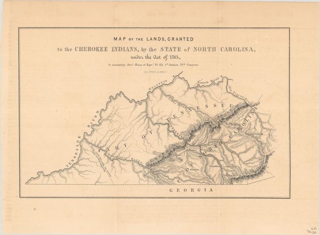
"Map of the Lands, Granted to the Cherokee Indians, by the State of North Carolina, Under the Act of 1783...", U.S. Government

Subject: Western North Carolina

Period: 1846 (published)

Publication: H.R. Doc. 185, 29th Congress, 1st Session

Color: Black & White

Size:
9.9 x 6.3 inches
25.1 x 16 cm
Download High Resolution Image
(or just click on image to launch the Zoom viewer)

This small map shows the Cherokee lands of western North Carolina. It locates a number of Cherokee villages including Tawuntoe, Sugar Town, Eones and Tuckalechee to name a few. The map also notes a "Division Line in 1809 between the Upper and Lower Towns," referring to a boundary within the Cherokee nation delineating those who wanted to establish a government (upper towns) and those that wanted to live traditionally (lower towns). The map was originally issued at the back of a 233-page House report concerning "Cherokee Disturbances" (not present here).

References:

Condition: B+

Issued folding with minor toning and a few spots of foxing.

Estimate: $300 - $375

Sold for: $220

Closed on 6/22/2022

Archived