Subject: Long Island, New York
Period: 1892-1923 (dated)
Publication:
Color: Printed Color
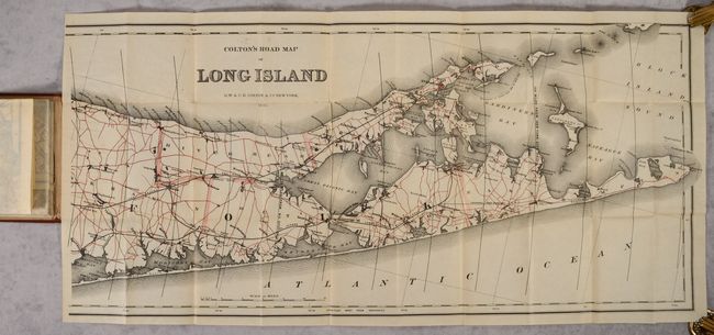
A. Colton's Road Map of Long Island, by G.W. & C.B. Colton, dated 1892 (63.0 x 14.4"). This scarce map covering all of Long Island is printed on two sheets with the western half attached to the inside front cover and the eastern half adhered to the inside rear cover. The transportation network is prominently depicted with roads highlighted in red overprinting and railroads identified in black including the Long Island RR, South Side RR, North Side RR, Sag Harbor Branch, and the Proposed Port Pond Bay line. The map locates towns, post offices, bays, lakes, offshore islands, and the street grid pattern of Brooklyn and Manhattan. Concentric circles radiate out from New York to Montauk, a distance of 115 miles. Folds into reddish-brown cloth covered boards (3.5" x 6.3"). OCLC lists only one location for this 1892 edition (New York Public Library) and 5 examples across all editions. Condition: Clean and bright with a little errant ink above the title. Covers have very minor wear.
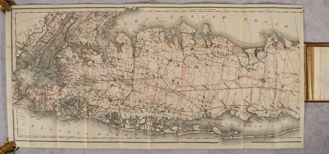
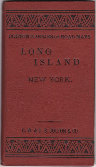
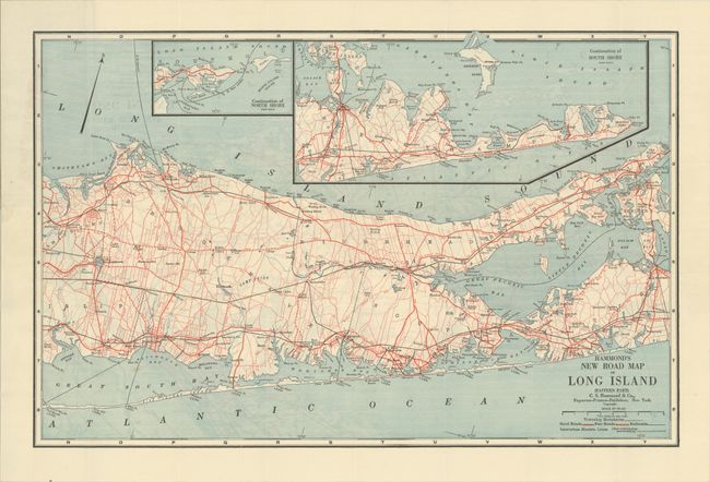
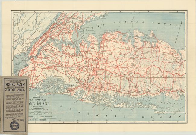
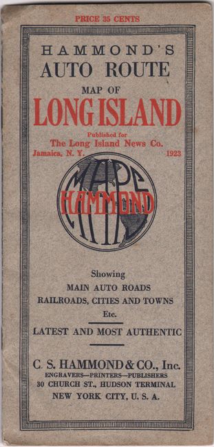
B. Hammond's Auto Route Map of Long Island, by C.S. Hammond & Co., dated 1923 (25.5 x 16.5"). This double-sided pocket map details the main roads, railroads and ferries for all of Long Island. The two sides overlap just to the east of Islip. Roads are boldly printed in red. The eastern map has insets of the North Shore and South Shore. In addition to the map, there is an index of towns, driving instructions between several points, and 3 single-page maps. Inside the front cover is an advertisement for Socony Motor Gasoline (Standard Oil), and the back cover has an ad for the Home Insurance Company of New York. Folds into stiff gray paper wrappers, 4 x 8.5" with a price of 35 cents. Condition: Map is near fine with light wear to the wrappers.
These two maps make for an interesting comparison, as the population of Long Island grew from about 1 million in 1892 to about 3 million in 1923.
References:
Condition: A
See description above.