Subject: Colonial Louisiana; Mississippi River
Period: 1763 (dated)
Publication: Le Petit Atlas Maritime…
Color: Hand Color
Size:
6.8 x 8.5 inches
17.3 x 21.6 cm
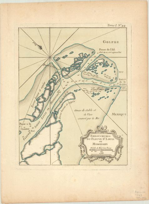
This uncommon chart details the Mississippi River delta as the river empties into the Gulf of Mexico. The map is oriented by a fleur-de-lis with north to the upper left. Fort Balise is shown on a small island at the mouth of the Southeast Pass and the channels include soundings and trees and other debris shown via icons. Jacques Nicolas Bellin had a distinguished 50-year career as one of France’s leading cartographers. He was the lead hydrographer to the French Navy upon the creation of France's hydrographic office, a member of the Académie de Marine and of the Royal Society of London. His maps of the French possessions in North America are particularly important.
References: Sellers & Van Ee #776; Tooley (MCC-96) #860.
Condition: A
Contemporary color with minor foxing in the blank margins.