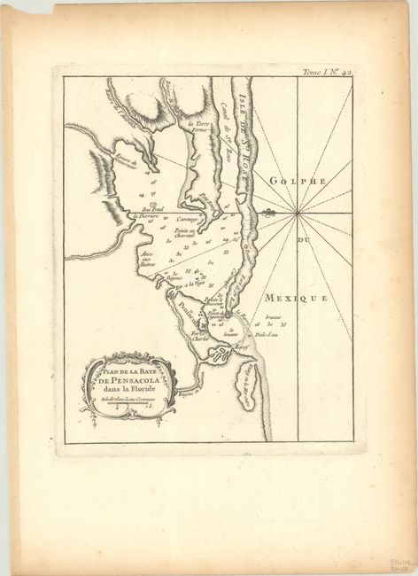
Subject: Pensacola, Florida
Period: 1764 (circa)
Publication: Le Petit Atlas Maritime
Color: Black & White
Size:
6.7 x 8.4 inches
17 x 21.3 cm
This copperplate engraved chart shows the bay with the tiny village of Pensacola protected by Fort St. Charles and by Fort de Ste. Rose which lies across the bay on a narrow spit of land. It locates a few houses in Pensacola. Soundings and a bit of topographical detail on the coast are all that is shown, locating Pointe au Chevruil, Fontaine, and several rivers including du Gouverneur, de l'Amirante, and du Jourdan. A rococo-style title cartouche incorporates a distance scale. The fleur-de-lys and rhumblines show north to the left. At upper right is "Tome. I. No. 42."
References: Phillips (Atlases) #3508, v. 1 #42; Sellers & Van Ee #1655.
Condition: A
A dark impression with light toning along the sheet edges.