Subject: Florida
Period: 1929 (dated)
Publication: Florida State Geological Survey - Twentieth Annual Report
Color: Printed Color
Size:
31.3 x 30.1 inches
79.5 x 76.5 cm
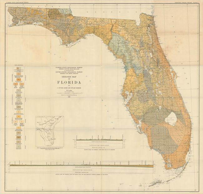
This large-scale map of the state was produced by C. Wythe Cooke and Stuart Mossom and published in the Twentieth Annual Report of the Florida Geological Survey. The detailed map presents 18 different geological types through both color and texture, covering the Eocene to Quarternary periods. The base map was supplied by the USGS and provides the reader with additional detail on rivers, lakes, swamps, railroads, and much more. Features two cross-sections at bottom: Cedar Keys to St. Augustine and Georgia State Line to Palm Beach. We found no past sales records for this 1929 map, and have offered only one other example from an earlier report in the last 30 years.
References:
Condition: B+
Issued folding with light toning at top right and minor foxing.