Subject: Connecticut
Period: 1795-1823 (circa)
Publication:
Color: Black & White
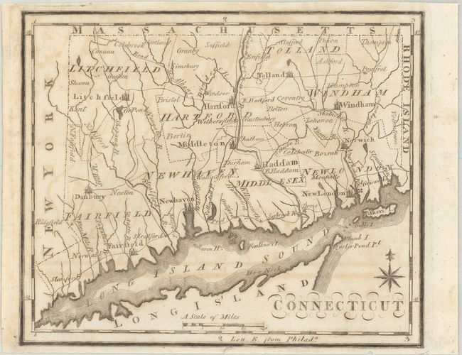
A. Connecticut, by Joseph T. Scott, circa 1795 (7.4 x 6.2"). This small map was issued in Scott's The United States Gazetteer and delineates 8 counties by dotted lines. Locates numerous cities and towns connected by a series of early roads including the Albany Road and Post Road. Condition: Issued folding with some offsetting. (B)
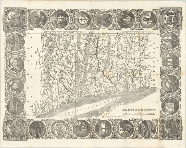
B. Connecticut, by R.H. Pease, circa 1823 (14.7 x 10.7"). This scarce wood engraving shows good detail of towns and cities, the road network, rivers and lakes, and topographical features. It is surrounded by a decorative border of the 24 state seals that were in existence at the time. The circa date is based upon the fact that Missouri's state seal is shown (1821) and the town of Madison on the central coast (incorporated in 1826) does not appear on the map. Condition: Issued folding on a bright sheet with some light scattered foxing. (B+)
References:
Condition:
See description above.