Catalog Archive
Auction 188, Lot 190

First Edition

"State Highway Map of California",
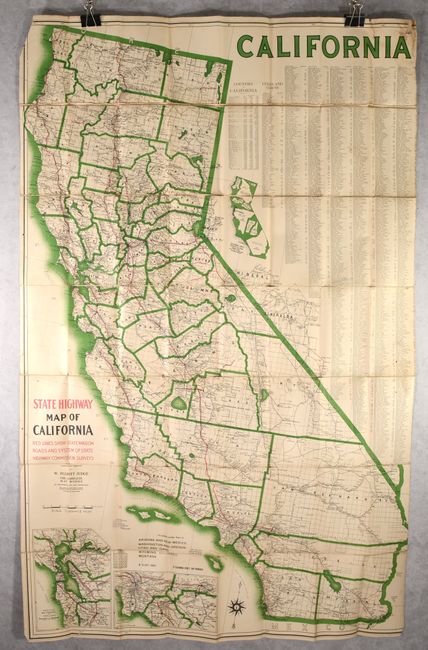
Subject: California

Period: 1913 (dated)

Publication:

Color: Printed Color

Size:
40.5 x 62.8 inches
102.9 x 159.5 cm
Download High Resolution Image
(or just click on image to launch the Zoom viewer)

This mammoth map of the state was compiled and engraved by W. Elliott Judge in San Francisco. It uses red lines to highlight the rapidly evolving highway system in the state with most of the roads being confined to the coastal and valley regions. Most of the mountainous areas and the Inland Empire are void of these improved roads. A legend at lower left further identifies railroads, proposed railroads, trolleys, stage roads, and more. The map features insets of Los Angeles, San Francisco, and one showing how multiple states would fit within California’s boundaries. A comprehensive index of counties, cities and towns flank the right side of the map. There are no past sales records for this first edition map and only two institutional examples located on OCLC. A very early road map of California on a grand scale.

For an alternative approach to show the size of states relative to California, see lot 188.

References:

Condition: B

Issued folding and backed on linen with the right side cut inside the neatline, apparently as issued, with some minor loss of index. There is a light damp stain and small hole in the top right corner, and the map is becoming loose from the linen along some folds.

Estimate: $200 - $250

Sold for: $190

Closed on 6/22/2022

Archived