Subject: Arkansas
Period: 1836-89 (dated)
Publication:
Color:
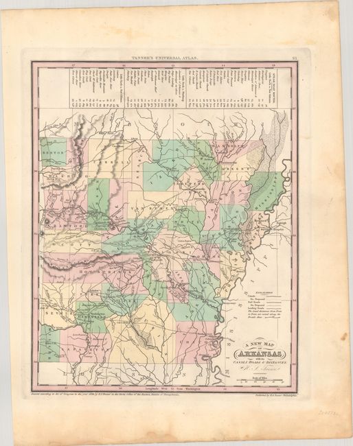
A. A New Map of Arkansas with Its Canals Roads & Distances, by Henry S. Tanner, from Universal Atlas, dated 1836, hand color (10.8 x 13.4"). Issued in the year of statehood, this lovely map is colored by county. The steamboat played an important role from the earliest days of the Arkansas Territory. Before being superseded by railroads, steamboats were the primary mode of transportation. A table at the top of the map includes the steamboat routes and distances from Little Rock to New Orleans, Pittsburg, and Fort Gibson. Well less than half of Arkansas' counties have been established including Miller County in the southwest corner. Condition: Contemporary color. The map image is clean and bright with some light soiling and dampstaining confined to the blank margin. (A)
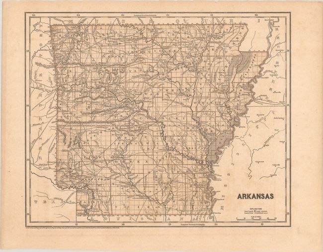
B. Arkansas, by Morse & Breese, from Morse's North American Atlas…, dated 1843, printed color (14.8 x 12.0"). This map was printed using the revolutionary cerographic process, a milestone in cartographic printing techniques. This early printed color technique was an important change in the way maps were produced and the only truly American cartographic publishing innovation. The map is finely delineated and is a great view of the early road system in the states. County configuration is current to 1842, with the addition of new counties Fulton, Montgomery, Newton, and Ouachita. Condition: A crisp impression on a lightly toned sheet. A short tear in the blank margin is closed with archival tape, well away from the map. (B+)
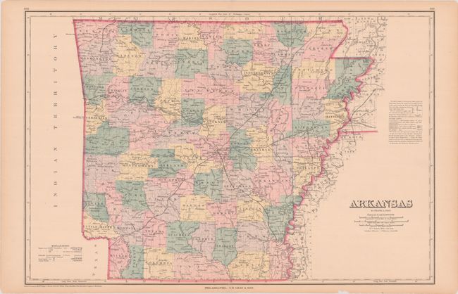
C. Arkansas, by Frank A. Gray, from The National Atlas, dated 1876, hand color (24.3 x 16.3"). Well engraved double-page map that is filled with information. It locates several named railroads, cities and towns, counties and county seats, watershed, and lakes. Between 1874 and 1880 railroad construction nearly doubled spurring growth and expansion. The map presents a fine view of the rapidly developing state. Published by O.W. Gray & Son in Philadelphia. Condition: Contemporary coloring. There are centerfold separations at top and bottom that have been closed on verso with archival tape and a few edge tears in the margins. (A)
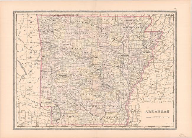
D. Arkansas, by William Bradley& Co., from Atlas of the World for Commercial and Library Reference, published 1889, hand color (22.4 x 16.5"). A fine, large map filled with information, particularly some of the smaller railways. Condition: Contemporary color. (A+)
References:
Condition:
See description above.