Subject: Grand Canyon, Arizona
Period: 1871 (dated)
Publication: United States Geographical Surveys
Color: Black & White
Size:
16.3 x 15 inches
41.4 x 38.1 cm
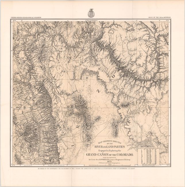
This is the map of Wheeler's epic journey in 1871 up the Colorado River from Camp Mohave (near Needles, California) to Diamond Creek. Published in 1878, it shows the course of the Colorado River from the California line to about midway up the Grand Canyon. Disaster, Portage, Castaway, Cascade, Winding, Roaring, and Long Rapids, Vernal Falls, the 1871 Rendezvous, and more are located. The routes of several prior expeditions are noted including those of Whipple, Sitgreaves, Ives, and Wheeler in 1869. A table lists the dates and camps of the river party, each keyed to the map. Detailed geographic information makes this a valuable record of western exploration. This is a single tint lithographed map printed by the Graphic Co. Photo-Lith. 39 & 41 Park Place, N.Y. The map was prepared by Weyss, Thompson & Lang.
References: Wheat (TMW) #1292.
Condition: A
Issued folding on a clean sturdy sheet with one short fold separation that has been closed on verso with archival tape.