Subject: Western United States
Period: 1877 (published)
Publication:
Color: Black & White
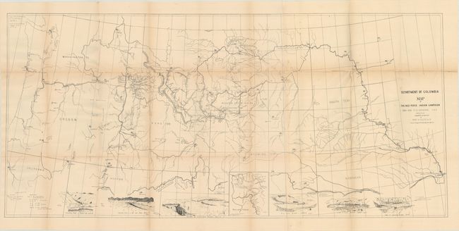
A detailed map of the historic and skillful retreat of the Nez Perce Indians in the winter of 1877. It identifies forts, battle sites, trails, direction of troop movements, etc. In the face of relentless pursuit of the troops under General Howard, Chief Joseph and his small band (less than 500 people counting women and children) fought one of the most extraordinary Indian Wars in American history. The map, which includes many notes and vignette views, records their retreat through the Bitterroot Mountains, twice across the Rocky Mountains, through Yellowstone National Park, across the Missouri River to the Bear Paw Mountains. They surrendered on Eagle Creek, only 30 miles from their destination. An extraordinary map that covers Washington, Oregon, Idaho, Montana, Wyoming, Dakota, and Nebraska. Seven vignettes along the bottom show various fights and battles plus an inset map titled "Scene of the Outbreak." A large and historical map of one of the most tragic Indian campaigns. The large map is accompanied by two smaller maps by Lazelle.
A. Department of Columbia Map of the Nez Perce Indian Campaign Brig. Gen. O.O. Howard U.S.A., (46.0 x 21.4").
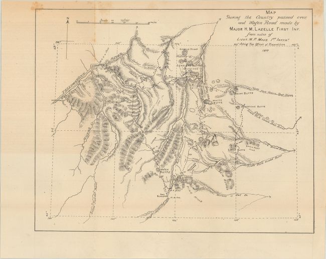
B. Map Showing the Country Passed Over, and Wagon Road Made by Major H.M. Lazelle First Inf. from Notes of Lieut. M.P. Maus, 1st Inftry, (11.5 x 9.3").
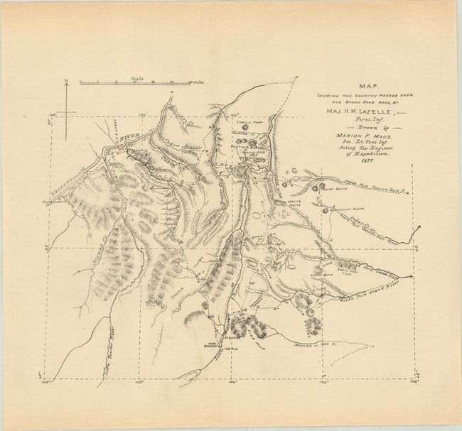
C. Map Showing the Country Passed Over, and Wagon Road Made..., (8.0 x 6.6").
References:
Condition:
Issued folding with some light toning and a bit of foxing. The large map has numerous fold separations that have been closed on verso with archival tape with some small loss at the fold junctions. Small maps (B+)/ Large map (B)