Subject: Colonial Mid-Atlantic United States
Period: 1729 (circa)
Publication: La Galerie Agreable du Monde...
Color: Hand Color
Size:
14 x 11.4 inches
35.6 x 29 cm
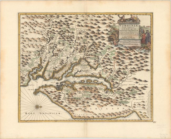
This is a rare map of the Chesapeake Bay based on the Hondius/Blaeu version of John Smith's prototype. Van der Aa purchased the plates of various Dutch publishers including those of Jacob van Meurs, who originally published this map under the title Nova Virginiae Tabula in Montanus' De Nieuwe en onbekende Weereld… in 1671. The plate has been extensively revised with a completely new title cartouche that incorporates a scale in German and French leagues, and the addition of longitude figures in the borders. A clearly defined eastern coastline of the Delaware peninsula now appears where a distance scale cartouche was previously located. Some new names, including Baltimore and three counties in eastern Maryland, have been added to the already extensive place names. Described in Coolie Verner's carto-bibliography on Smith's Virginia as Derivative 8, state 2 (in Tooley's The Mapping of America). The Van der Aa state was published in his rare La Galerie Agreable du Monde. It is much more rare than the other states.
References: Burden #412; Tooley (Amer) p. 169.
Condition: A
A fine impression on a watermarked sheet. There are a few light dampstains along the sheet edges and manuscript page number in the bottom right margin.