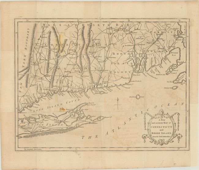
Subject: Colonial New England United States
Period: 1780 (published)
Publication: Universal Magazine
Color: Black & White
Size:
13.4 x 10.3 inches
34 x 26.2 cm
This uncommon Revolutionary War era map extends from Bedford, CT to Plymouth, MA with the eastern half of Long Island depicted at bottom. Locates a number of towns and settlements in both the Connecticut Colony and Rhode Island Colony with a system of early roads connecting them together. A small sliver adjacent to the "New York Boundary" is noted as "Lands Granted to New York by Connecticut." Adorned by a decorative title cartouche in the lower right corner. No engraver's signature. Published in the October 1780 issue of Universal Magazine.
References: Jolly #UNIV-189; Phillips (Maps) p. 247; Sellers & Van Ee #829.
Condition: B
Issued folding on watermarked paper with light offsetting and some minor staining at left. A binding trim at lower right has been replaced with heavy tissue.