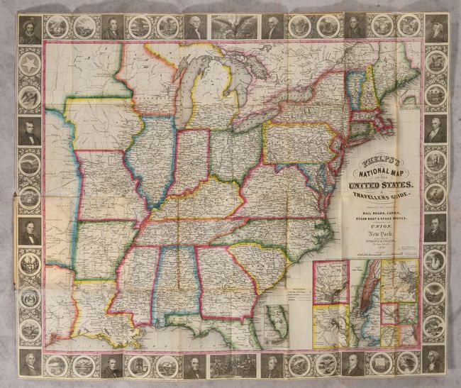
Subject: Eastern United States
Period: 1848 (dated)
Publication:
Color: Hand Color
Size:
25.3 x 21.3 inches
64.3 x 54.1 cm
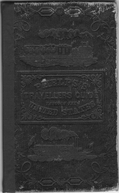
This is the second edition of this folding pocket map that extends to the Great Plains and includes part of Texas with two large unnamed regions extending northward, presumably the Indian territories. The map is filled with details including roads, towns and villages, railroads, rivers and much more. Delineates the Trader’s Route to Santa Fe in Missouri and through the territory to the west. Names numerous Indian tribes, Burial Grounds, and trading depots. It is embellished with a surrounding border featuring finely engraved portraits of 16 famous Americans, the seals of 30 states including Texas (but not California), the signing of the Declaration of Independence, and the seal of the United States. This early edition does not have the large inset "Map of Oregon, California & Texas" that would later appear at lower right. Here the original insets include the vicinity around Baltimore, Philadelphia, Boston, New York, Pittsburgh, Cincinnati, Chicago, and St. Louis. The southern tip of Florida and the north part of Maine are shown in insets as well. Hardbound in brown boards (3.5 x 5.7").
References: Howes #P-291.
Condition: B+
Issued folding on a clean bright sheet with several short splits at the fold junctions. There are a few tissue repairs on recto along the two left folds of the map that are glued to the front board. The front cover has average wear and the rear cover has been recently replaced in brown cloth.