Subject: Eastern United States
Period: 1803-36 (circa)
Publication:
Color: Hand Color
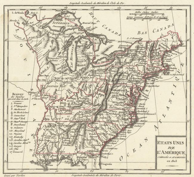
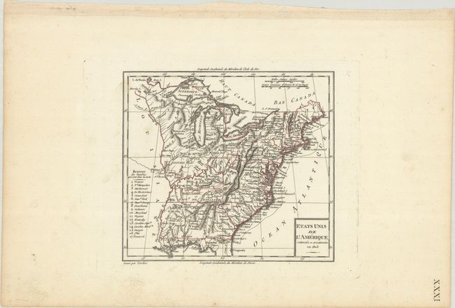
A. Etats Unis de l'Amerique, Corriges et Augmentes en 1803, by Tardieu, dated 1803 (8.0 x 7.1"). Nice view of the early United States with its western boundary on the Mississippi River and seventeen states listed. Includes a large unnamed Northwest Territory that extends to the Mississippi and Ohio Rivers and includes Illinois. Ohio, which had just been admitted as a state the year this map was published, is shown in a very early, truncated configuration. Everything west of the Mississippi is named as Louisiane. Good detail throughout including locating the several Army lands (Wabash, Illinois, Ohio, and New Jersey Companies) and numerous native tribes. Condition: Clean and bright with contemporary outline color on a wide-margined sheet with marginal soiling. (A)
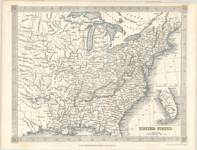
B. United States, by Alexander Findlay, circa 1836 (9.8 x 7.6"). This handsome map of the United States extends to show the eastern part of the Republic of Texas and a vast, unnamed western territory to the northwest of Missouri and Illinois. Arkansaw is shown in its largest configuration including present-day Oklahoma. The combination of a Republic of Texas (1836) and a large Arkansas Territory (became a state in mid-1836) suggest a circa date of 1836. Michigan, just a year or so away from statehood, is named, but Wisconsin is not yet organized. There is excellent detail of rivers and mountains, and many towns and cities are named throughout. An inset at bottom right covers the southern part of Florida. Surrounded by a decorative border. Published in London by Thomas Kelly. Condition: Very light foxing. (B+)
References:
Condition:
See description above.