Subject: Eastern United States
Period: 1797 (dated)
Publication:
Color: Hand Color
Size:
15.5 x 13.7 inches
39.4 x 34.8 cm
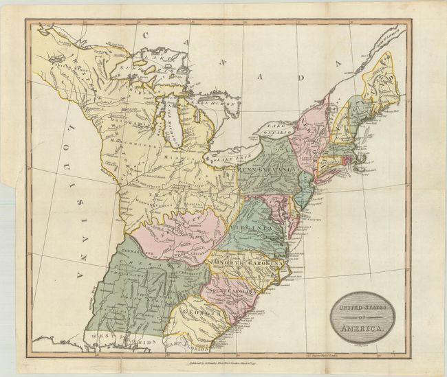
This uncommon early map of the United States extends from East & West Florida north to the lands of the Eastern Sioux and west to Lake of the Woods. The region to the west of the Mississippi River is labeled Louisiana and is completely devoid of detail. The shapes of the states are somewhat distorted, with Tennessee named but not defined by borders. A huge Western Territory occupies everything east of Pennsylvania and north of Kentucky. A large area south of Kentucky and west of Georgia to the Mississippi is unnamed but filled with Indian names. Published by George Kearsley in London. This map was later published in G.G. Robinson's Atlas to Cruttwell's Gazetteer beginning in 1799 without Neele's imprint beneath the title cartouche.
References: cf. McCorkle #799-10; cf. Phillips (Atlases) #692-7.
Condition: B+
Issued folding on paper with a Strasbourg Lily watermark. There is a binding tear at left that extends 1" into the image that has been closed on verso with archival tape.