Subject: United States, Aviation
Period: 1945 (circa)
Publication:
Color: Printed Color
Size:
31.2 x 23.3 inches
79.2 x 59.2 cm
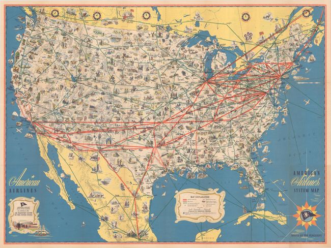
This densely illustrated pictorial map is color-coded to show airline routes in the United States and extending to portions of Canada, Mexico, the Bahamas and Cuba. American Airlines routes are depicted by thick red lines, while other routes are noted by a thin green line. Filling the map are numerous vignettes displaying points of interest, leisure activities, historical sites, and more. The verso contains twelve strip maps showing airline routes between various cities and a section of descriptive text entitled "The Radio Beam is the Highway of the Air." The use of radio signals for commercial aviation increased exponentially following the military's enhancements of this technology during World War II.
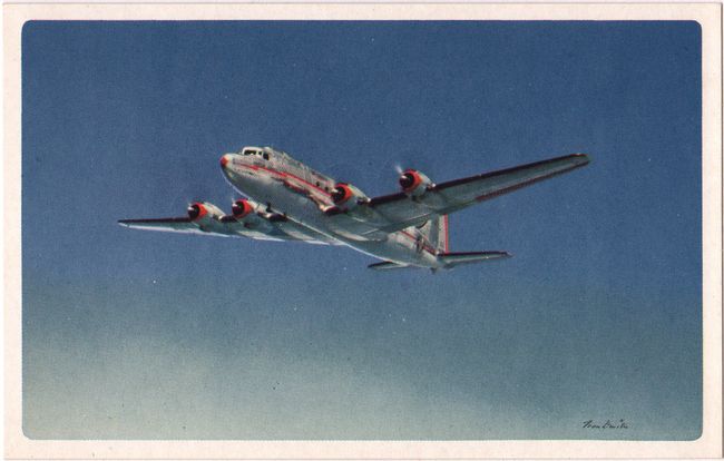
Accompanying the map is an unused postcard issued by American Airlines with photo illustration by Ivan Dmitri.
References:
Condition: B+
A colorful example on a clean sheet, issued folding. There is an archivally repaired 3" fold separation at top right and related abrasion with minor image loss in the Atlantic Ocean.