Catalog Archive
Auction 188, Lot 116

"A Plan of the Fort and Bay of Frontenac with the Adjacent Countries", Kitchin, Thomas

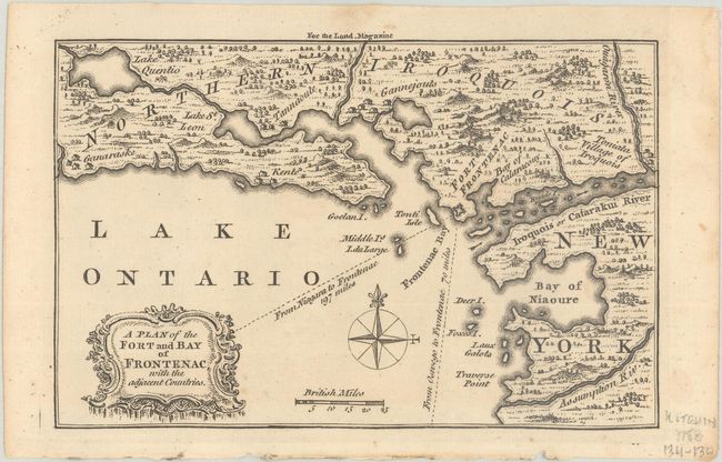
Subject: Colonial New York & Ontario

Period: 1758 (published)

Publication: London Magazine

Color: Black & White

Size:
7.2 x 4.6 inches
18.3 x 11.7 cm
Download High Resolution Image
(or just click on image to launch the Zoom viewer)

Strongly engraved map published during the French & Indian War. Centered on Lake Ontario it shows Fort Frontenac on the western shore of New York and Ontario above. Locates the settlements of Kent and Ganaraske, the Toniata Village of Iroquois, the Catarackui River, Deer Island, the Bay of Niaoure and more. Published in the November 1758 London Magazine: or, Gentleman's Monthly Intelligencer.

References: Jolly #LOND-152.

Condition: A

Near fine with minor soiling in the margins.

Estimate: $160 - $190

Sold for: $120

Closed on 6/22/2022

Archived