Subject: Eastern United States & Canada
Period: 1816-1820 (circa)
Publication:
Color: Black & White
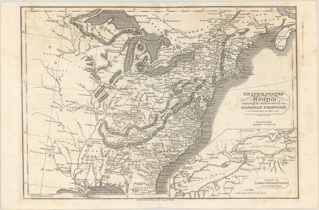
A. United States of America Exhibiting the Seat of War on the Canadian Frontier. From 1812. to 1815, by Edward Baines, dated 1816 (13.7 x 9.6"). An uncommon map of the early United States, published shortly after the War of 1812. The map details the eastern United States including the plains region to the west of the Mississippi. Mississippi is a large territory that includes present-day Alabama. Michigan Territory is named. The map is filled with early settlement locations and Indian villages. Inset with a "Chart of Lakes Erie and Ontario on an Enlarged Scale," where much of the action took place during the war. Engraved by R. Walker. Condition: On paper with an "HS 1814" watermark and light foxing that is a bit cockled along the centerfold.
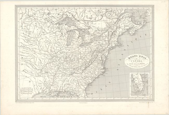
B. Etats Unis et Canada, by Charles V. Monin, circa 1820 (17.8 x 12.3"). Detailed steel engraved map showing the eastern part of the U.S. and southeastern Canada. Calligraphy title in an oval below which is an inset map of the south part of Florida, including the Keys. West of the Mississippi River only Missouri and Arkansas Territory are organized, with the balance made up of districts controlled by various Indian Tribes. Condition: On a bright sheet with some soiling that enters the border at bottom right.
References:
Condition: B+
See description above.