Subject: Colonial Eastern United States & Canada
Period: 1778 (dated)
Publication: Atlante Novissimo
Color: Hand Color
Size:
15.9 x 11.8 inches
40.4 x 30 cm
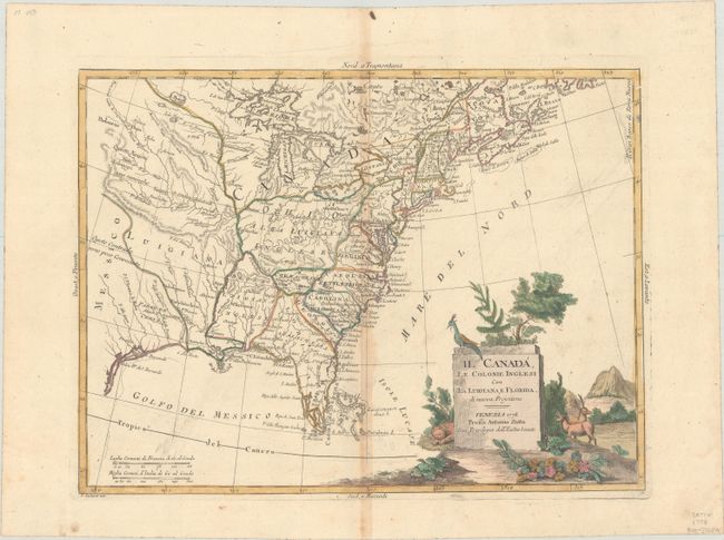
This finely engraved Revolutionary War map shows all of the British colonies. It extends to include Nova Scotia, all of the Great Lakes, and westward to name Cenis in Texas. It is filled with early forts, Indian lands, watershed, and limited topography. West of the Mississippi River is the large Luigiana (Louisiana) with the lower English Louisiana shown roughly in today's Mississippi. Florida is oversized and misshapen, extending to the northwest resulting in a small bean-shaped Georgia. In the Midwest is a huge region labeled Ohio Alta Luigiana Inglese that stretches from the Mississippi River to Virginia and Pennsylvania. The area that later becomes the Northwest Territory is not named. An area west of the Carolinas is Cherachesia. Attractive monolith-style title cartouche features indigenous animals, including a peacock. Two distance scales. Blank verso. A great Revolutionary-period map that is dated 1778.
References: Rumsey #5007; Shirley (BL Atlases) T.ZAT-1a, Vol. IV #39.
Condition: B+
Contemporary color on a sheet with a three crescent moons watermark. There is light toning along the centerfold and a pair of wormholes adjacent to the lower centerfold.