Subject: Western Hemisphere - America
Period: 1623 (circa)
Publication: Grands Voyages, Part XXII
Color: Black & White
Size:
11.9 x 7 inches
30.2 x 17.8 cm
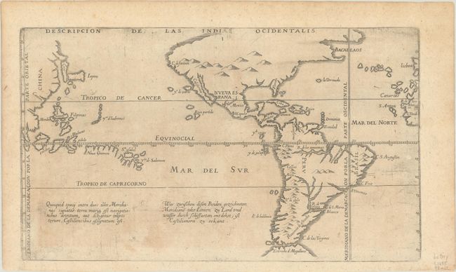
This scarce and important map of the Americas and the Pacific Ocean is based on the manuscript charts of Juan Lopez de Velasco. It depicts the Papal line of demarcation between the Portuguese and Spanish spheres of influence. Being Spanish in origin, the map places the Philippines and Moluccas some 40 degrees too far east. There are both Latin and German script notations in the South Pacific. Johann Theodore de Bry continued his father's Grands Voyages with his publication of the twelfth part, which was an edition of Antonio de Herrera y Tordesillas' collection of voyages.
References: Burden #201; Garratt (TMC-9) #G-24.
Condition: B+
Minor uneven toning on paper with a small coat of arms watermark and some printer's ink residue.