Subject: Atlases
Period: 1846 (published)
Publication:
Color: Hand Color
Size:
9.8 x 12.1 inches
24.9 x 30.7 cm
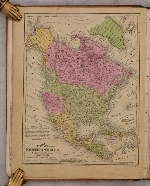
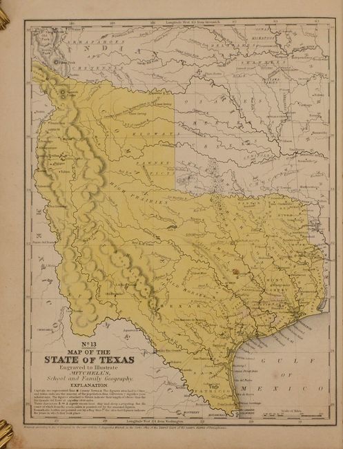
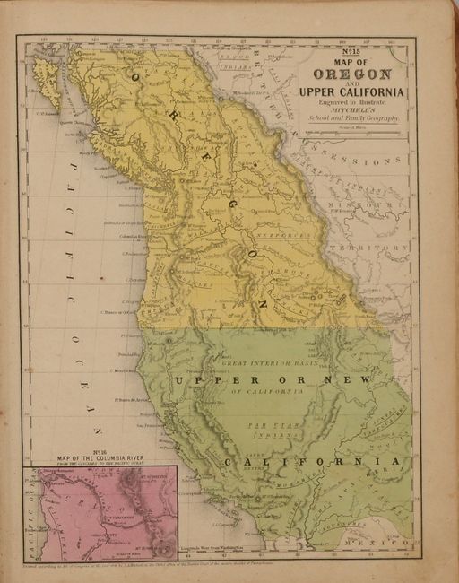
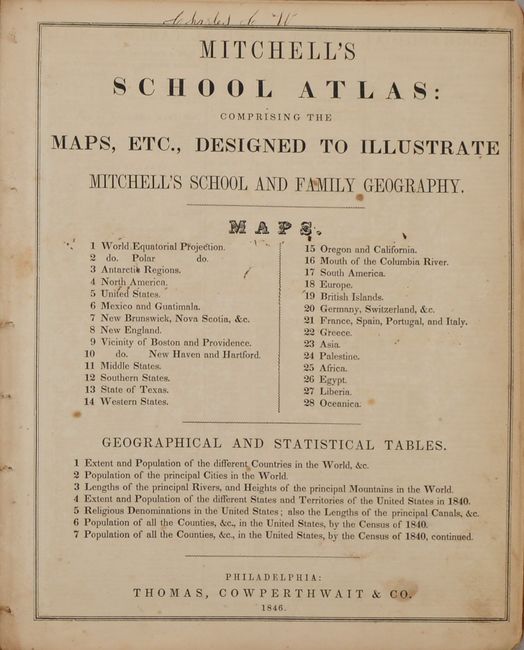
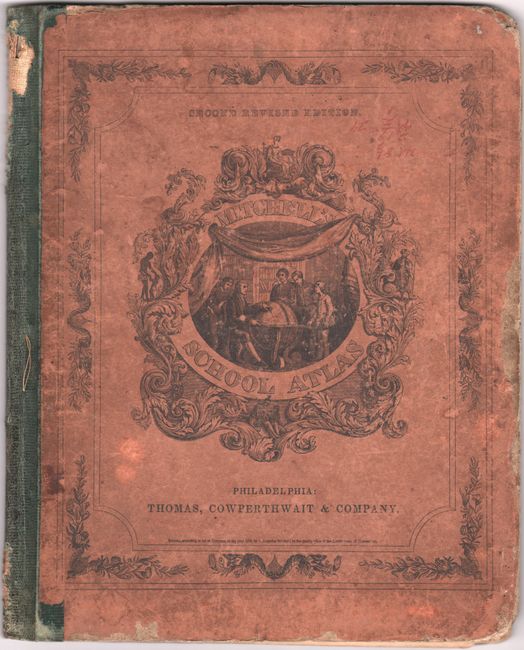
Mitchell's famous school atlas is complete with 28 maps, many double-page, along with tables and statistics. Most of the maps are dated 1839 except the Texas and Western States maps are dated 1846 and show Texas immediately following annexation. Texas is shown in its largest configuration with the stove-pipe panhandle continuing through the Green Mountains in present-day Colorado. This edition is also the first to name Dallas. The double-page map of the United States features the large Oregon Territory filling the Northwest, shows Mexico in control of the Southwest and locates a large area in Texas labeled "Herds of Buffaloes and Wild Horses." Hardbound with pictorial paper over boards. This is the second revised edition, published by Thomas, Cowperthwait & Co.
References:
Condition: B
The maps are good to very good with light toning and soiling, and minor foxing. The map of the United States is a bit loose and has a 2" centerfold separation at bottom. The binding is shaken and the boards are heavily worn and soiled as is usually seen.