Subject: Northern Africa
Period: 1640 (dated)
Publication:
Color: Hand Color
Size:
19.6 x 14.1 inches
49.8 x 35.8 cm
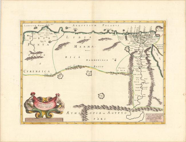
This handsome map shows the extent of the Patriarchate of Alexandria in Roman times. It covers the area between Benghazi (Berenice) and the Red Sea. A majority of the towns and cities named are concentrated around the Nile. There is good detail of the region's mountains and lakes. In the bottom left corner there is an elaborate title cartouche featuring mermen.
References:
Condition: A
A sharp impression on a bright sheet with contemporary outline color in the map and later color in the cartouche, with a large coat of arms watermark, a hint of toning and offsetting along the centerfold, and three small worm holes in blank areas of the map.