Catalog Archive
Auction 187, Lot 631

"Archipel des Indes Orientales, qui Comprend les Isles de la Sonde, Moluques et Philippines, Tirees des Cartes du Neptune Oriental", Robert de Vaugondy/Santini

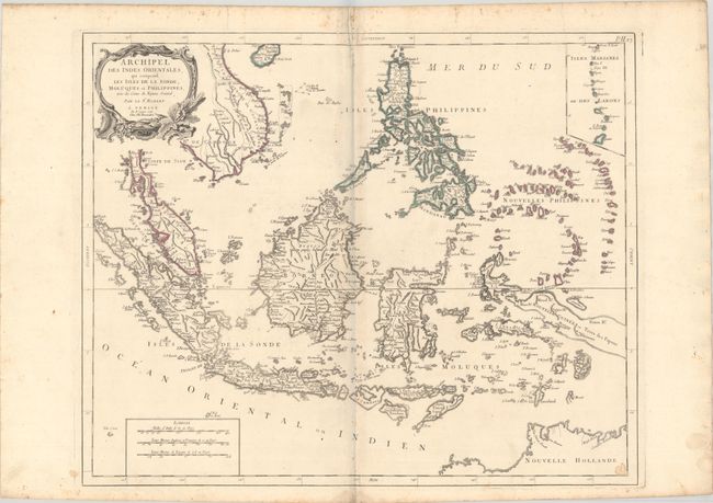
Subject: East Indies - Indonesia

Period: 1778 (dated)

Publication: Atlas Universel

Color: Hand Color

Size:
23.3 x 19.1 inches
59.2 x 48.5 cm
Download High Resolution Image
(or just click on image to launch the Zoom viewer)

A detailed depiction of the region centered on Borneo, showing Sumatra, Java, the Malay Peninsula, the Philippines, and the tips of New Guinea and Northern Australia (Nouvelle Hollande). An inset at upper right depicts the Marianas. The map names Sincapoura (Singapore) and Batavia (Jakarta) and locates the important Spice Islands. A decorative rococo-style title cartouche and three distance scales are also featured. Published in Remondini's 1784 edition of Atlas Universel.

References: cf. Pedley #413.

Condition: B+

Issued on "R" watermarked paper with minor toning and a small stain in the bottom right corner. There is light scattered foxing mostly in the margins.

Estimate: $400 - $475

Sold for: $250

Closed on 4/27/2022

Archived