Subject: Philippines
Period: 1752 (dated)
Publication: Histoire Generale des Voyages
Color: Black & White
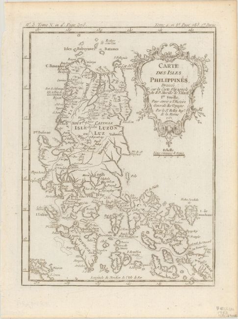
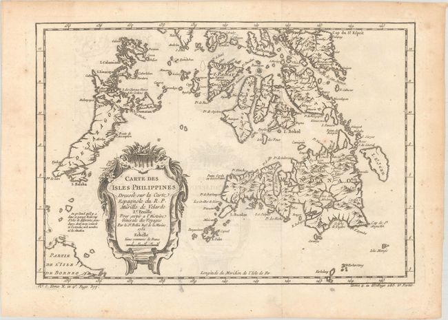
This lot is an attractive pair of maps covering the Philippines, both with lovely rococo-style title cartouches. The first map depicts the northern islands of the Philippine archipelago, including Luzon and Mindoro. The notable city of Manila is located as well. The map is filled with nice detail throughout. The second is a double page chart which is focused on the southern islands including Mindanao, Palawan, Panay, and part of Borneo. Although Bellin credits Jesuit priest Pedro Murillo Velarde as the source for the cartography of the region, Velarde's original map did not include the mythical island of St. Johann, which Bellin depicts to the east of Mindanao on the second map.
A. Carte des Isles Philippines, Dressee sur la Carte Espagnole du R.P. Murillo de Velarde Ire. Feuille pour Servir a l'Histoire Generale des Voyages, (6.2 x 8.3"). Condition: On a bright sheet with a printer's crease at bottom and light toning along the top edge of the sheet. (A)
B. Carte des Isles Philippines Dressee sur la Carte Espagnole du R.P. Murillo de Velarde 2e. Feuille pour Servir a l'Histoire Generale des Voyages, (11.9 x 8.3"). Condition: A sharp impression, issued folding on a sheet with a bunch of grapes watermark, light offsetting, and some light foxing. (B+)
References:
Condition:
See description above.