Subject: China, Korea & Japan
Period: 1655 (published)
Publication:
Color: Hand Color
Size:
14.1 x 22 inches
35.8 x 55.9 cm
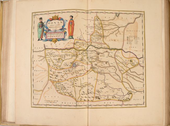
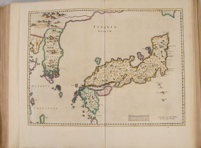
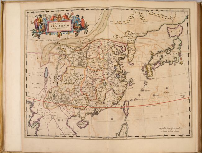
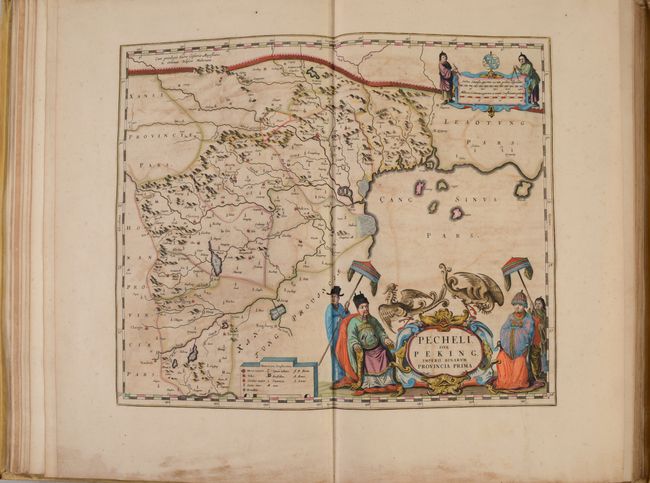
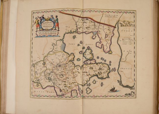
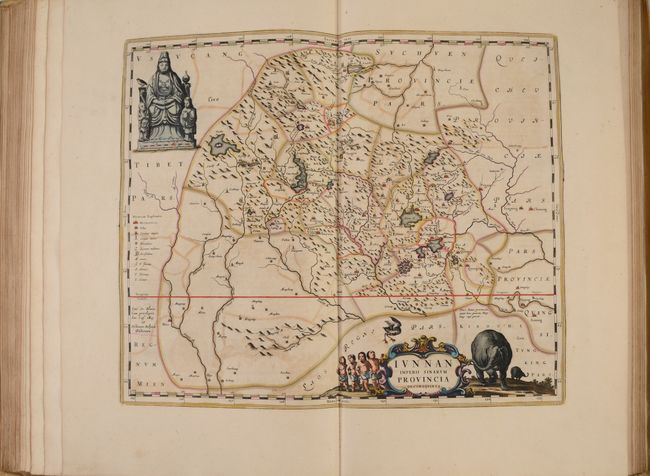
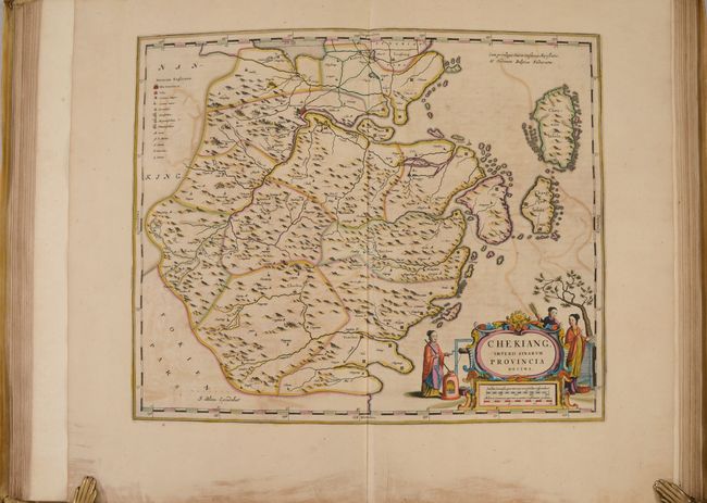
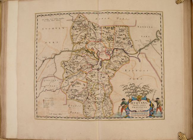
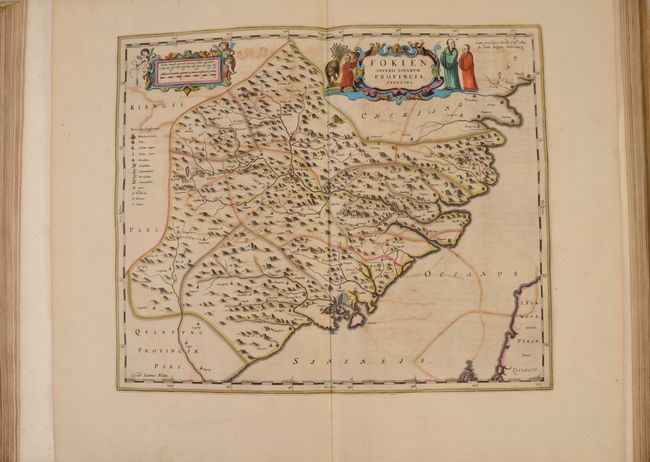
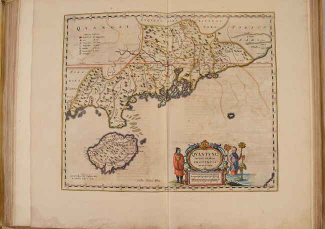
Volume XI of Blaeu's superb atlas is the first western atlas of Asia. This volume is based on the remarkably accurate compilations of the Jesuit Father Martino Martini during his travels between 1643 and 1650. On his return trip to Rome, Martini's ship was blown off course, forcing him to land in Norway. He subsequently made a stop in Amsterdam where he met Johannes Blaeu, and agreed to assist in the production of the Atlas Sinensis. Martini succeeded in producing very accurate maps of Japan, China, and their provinces, which may be attributed to Martini's skill as well as access to Chinese maps during his travels. His maps were copied extensively for the next century. Of particular note, in Imperii Sinarum and Iaponia Regnum, Korea is shown as a peninsula for the first time on a map produced outside of China. The Jesuit missions are indicated throughout the maps by a cross above the letters "IHS." The atlas includes a general map of China, fifteen maps of individual Chinese provinces, and a general map of Japan.
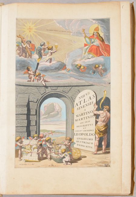
The exquisite title page features the title on the door to an open portal. In the foreground, putti hold a map of China and make measurements on a globe within the continent of Asia. In the skies above an emblem of Jesus Christ (HIS) emits a radiant light that reflects off of a mirror held by the Pope. The reflected beam lights a beacon held by a putto, with other putti above him holding emblems of the Word, including a crucifix, a book (the New Testament), and vessels associate with the Eucharist. A quotation emanating from the Pope's mouth translates as "Go, swift messengers, to a nation powerful but divided" (Isaiah 18.2).
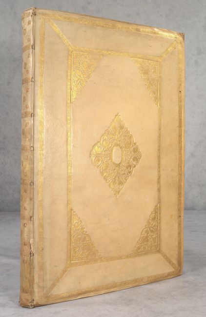
The atlas is complete, with all maps, text pages and title page present. Includes Martini's description in 171 pages, plus 8 dedication pages, 17 maps, 19 pages of tables, 6 index pages, and 33 'additamentum' pages of text. This is the first edition, second issue. Elephant folio, hardbound in full contemporary vellum with gilt embossing on covers and spine, and more recent endpapers. All edges gilt. A hand-colored copper-engraved portrait of Johannes Bracherius is mounted on the front pastedown; the engraving is by G. B. Bonacina after C. Fiore (around 1650).
References: Goss (Blaeu) p. 210-223; Shirley, (TP) #53A; Taschen/Krogt #X/12; Van der Krogt (Vol. II) #2:502.
Condition:
The maps have crisp impressions with superb, full contemporary color on lightly toned sheets with some color offsetting, and range in condition from "B+" to "B." A few of the maps have additional staining. There are a few occasional short tears in the blank margins. The title page is much brighter than the maps, with a couple of extraneous creases and marginal soiling (grade: A). The text has light toning and foxing. The covers have bumped edges with light soiling and there are a few small cracks along the spine (grade: B+).