Subject: Eastern & Northern Asia
Period: 1701 (circa)
Publication: A New Set of Maps Both of Antient and Present Geography
Color: Black & White
Size:
19.8 x 14.2 inches
50.3 x 36.1 cm
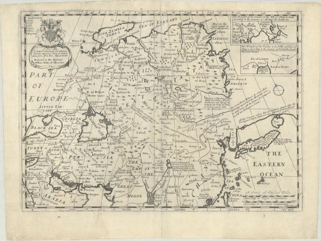
This interesting English map covers from the Black Sea through Japan. It is based on Nicolas de Fer's L'Asie suivant les Nouvelles (1700), which presented some interesting ideas concerning the northeast coast of Asia with a continuous land bridge extending from Korea to North America. Wells' map is filled with interesting explanatory notes including the note on the coastline above Japan that stretches eastward and off the map in the direction of America, "All this Coast, as well as that of Japon, are drawn after the Portuguese Charts, which are very different from the French Sr. Sansons." Two insets, both showing the region northeast of China, were compiled from two different Jesuit reports. The map is decorated with a fine title cartouche with the arms of the Duke of Gloucester, to whom the map is dedicated. Engraved by Sutton Nicholls.
References: Shirley (BL Atlases) T.WELL-1a #29.
Condition: B+
A dark impression on a sheet that has been backed with tissue to repair a 4" centerfold separation at top. Several small edge tears in the top blank margin have also been archivally repaired.