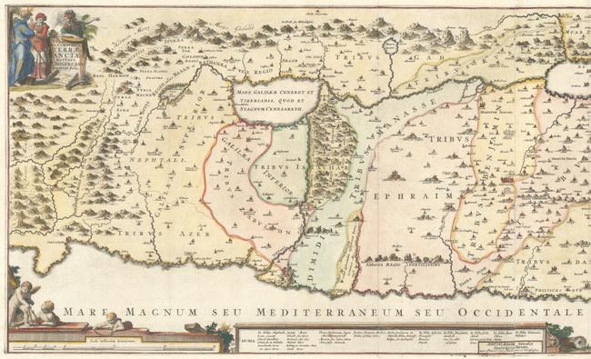
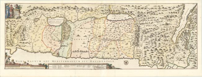
Subject: Holy Land
Period: 1720 (circa)
Publication:
Color: Hand Color
Size:
44.8 x 15.3 inches
113.8 x 38.9 cm
This uncommon, panoramic view of Israel was created by the Flemish theologian, Jacques Bonfrere. The map is oriented with north at top left and is divided into the twelve tribes with a key at bottom. The Wandering of the Children of Israel is shown with the 42 encampments. The title cartouche includes Moses, Aaron and a Roman soldier. Two sheets joined, as issued. Published by Halma.
References:
Condition: A
A sharp impression, issued folding on a bright sheet with rosary beads watermarks. There are professional repairs to a few minor separations along the folds, a chip at top right, and a worm track that just crosses the neatline at top left with a minute amount of the border replaced in facsimile.