Subject: Western Italy
Period: 1652 (circa)
Publication:
Color: Hand Color
Size:
19.2 x 13.6 inches
48.8 x 34.5 cm
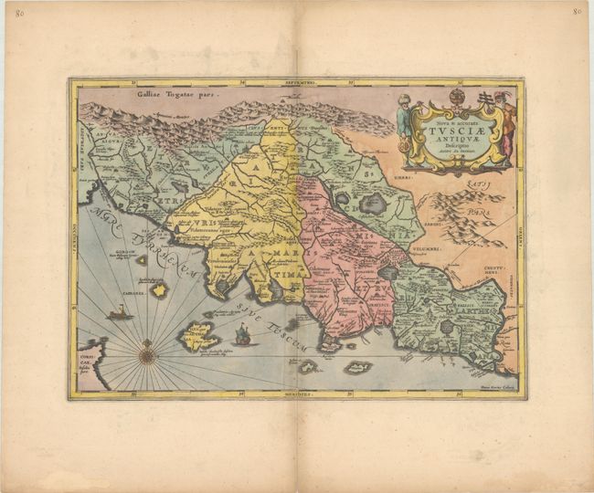
Pieter Van Den Keere (Petrus Kaerius) engraved this attractive map of ancient Tuscany. It is based on Ortelius’ map that was in turn based on Bellarmati's map supplemented by classical sources. The map is very detailed and includes the coastal islands. It locates the major Etruscan and Roman settlements and the Roman roads. The map is embellished with surveyors flanking the title cartouche, a compass rose, and sailing ships. Blank verso with manuscript number 80 on both recto and verso. First issued in Georgius Hornius' Accuratissima Orbis Antiqui Delineatio, which included maps from Johannes Jansson's historical atlas and Abraham Ortelius' Parergon.
References: Van der Krogt (Vol. I) #7200H:1.
Condition: B+
A crisp impression on a sheet with wide original margins. There is faint offsetting in the image, minor soiling along the centerfold, and a centerfold separation confined to the bottom blank margin that has been closed on verso with archival tape.