Subject: Eastern Europe, Poland
Period: 1740 (circa)
Publication: Nouvel Atlas Geographique & Historique...
Color: Hand Color
Size:
8.6 x 6.4 inches
21.8 x 16.3 cm
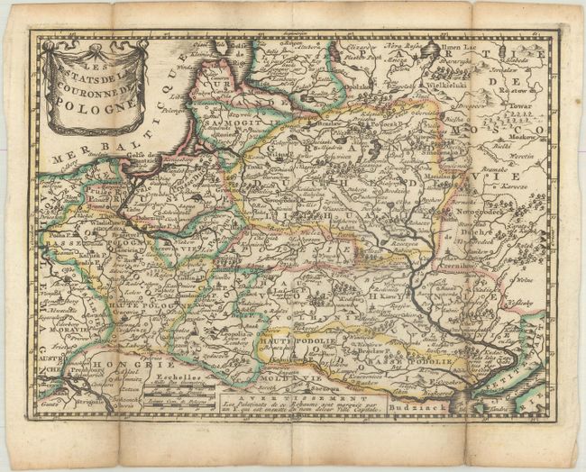
This uncommon small map illustrates the region of Eastern Europe that contains present-day Poland, Lithuania, the Russian enclave of Kaliningrad, Belarus, Moldova and part of the Ukraine. Along the lower Dnieper River is a note that the islands in the river are inhabited by the Cossacks. Adorned with a drape-style title cartouche. For his Nouvel Atlas, Leth made close copies of Jacques Chiquet's maps published in Le Nouveau et Curieux Atlas in 1719.
References: Shirley (BL Atlases) T.LETH-1a.
Condition: B+
A dark impression with contemporary outline color, issued folding with light toning along the folds and short fold separations that have been repaired with paper on verso.